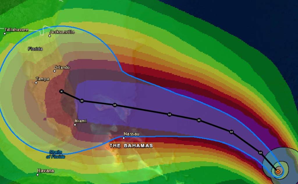
Dorian turns into a Category 2 hurricane, “could be the strongest direct hit to Florida since Hurricane Andrew”

11PM Update:
Hurricane Dorian is now expected to hit Florida even harder than previously thought, prompting a widened state of emergency.
The storm is on track to make landfall early Monday as a powerful Category 4 hurricane.
According to several reports, it could be the strongest direct hit to Florida's east coast since Hurricane Andrew in 1992.
Hurricane Dorian is moving northwestward with maximum sustained winds of 105 miles per hour. The center is currently about 330 miles east of the southeastern Bahamas.
It's current location is at 23.3°N 68.4°W, and the storm is moving northwest at 12 miles per hour with minimum pressure of 997 mb.
"A track on the south side of the forecast cone would be damaging to Southwest Florida. A landfall anywhere directly east or southeast of Lake Okeechobee would likely bring hurricane-force winds around the lake along with flooding rain of at least six inches. In this potential worst-case scenario, tropical-storm-force winds across Lee, Collier, and Charlotte counties would lead to some power outages and areas of coastal flooding. We would take quite a punch even though Dorian will weaken overland!
But, if Dorian makes landfall significantly north of Lake Okeechobee, the storm will be less severe in Southwest Florida. There is simply no reasonable way to say how this will go as we sit four to five days from Dorian's greatest impact on Florida." said NBC2 in the 11 pm, Thursday night forecast.
WATCH NBC2 LIVE:
Dorian may be "extremely dangerous" Category 4 hurricane when it makes landfall
The risk of life-threatening storm surge and hurricane-force winds this weekend continues to increase in the nortwestern Bahamas, and hurricane watches could be issued there tonight or Friday.
There is an increasing likelihood of life-threaning storm surge along portions of the Florida east coast late this weekend or early next week, although it is too son to determine where the highest storm surge will occur.
The risk of devastating hurricane-force winds along the Florida east coast and peninsula late this weekende and early next week continues to increase, although it is too son to determine where the strongest winds will occur.
Heavy rains are expected.


